

The Find Spot and its Environment
Gohar Tepe is situated in the Iranian province of Mazandaran, approx. 33 km east of the province capital of Sari (coordinates 36°40’43’’ North and 53°24’01’’ East). It is a relatively large, but at the same time comparatively flat hill which is divided into individual heights. The central main hill measures about 10 hectars. Together with the surrounding heights, the overall area of the settlement, however, comprises almost 50 hectars. Thus, Gohar Tepe is the largest archaeological find spot in the coastal plain of Mazandaran.
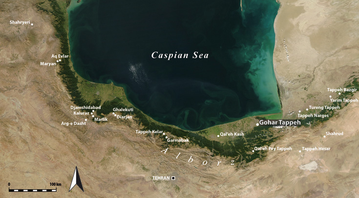
Bronze- and Iron Age find spots in Northern Iran
The find spot was discovered during a survey conducted in the years of 2000 and 2002 in the coastal plain of Eastern Mazandaran. The supra-regional importance of the find spot became clear immediately, but also its endangerment by recent agricultural activities. For this reason, the Cultural Heritage Organisation of Mazandaran initiated archaeological excavations at Gohar Tepe as early as in 2003, which have been conducted as a common project with the Ludwig Maximilians Universität München since spring 2009. The find spot has an extremely favourable location. While the first foothills of the Alborz Mountains rise only a few hundred metres further south, the coast of the Caspian Sea to its north is only a few kilometres away. The modern main road from Sari to Gorgan runs along the southern border of the hill. We presume that there used to be an important East-West connection already at Prehistoric and Early Medieval times.

Landscape near Gohar Tepe